
VDCESMTWIDTH is part of Easement Check; the full section follows.
Checks the easements already drawn against the width each pipe reach needs, reads their labels, and reports the worst station of every reach. You declare the public right-of-way and the private streets; the tool never guesses.
Per reach
- Required width from the rule and its depth basis: invert (cover + OD - wall) or bottom of pipe (cover + OD + bedding, GSWSA).
- Cover from a named surface, the pipe's reference surface, or the structure rims - named on every row.
- Public ROW = no easement required; private street = full width; partly in ROW = checked outside only.
- Clearance square to the pipe both ways at every station; centered / edge-clearance rules checked per side. Parallel lines = degraded mode.
- Label: leading width + PUBLIC / PRIVATE; required / drawn / labeled three-way disagreement flagged.
- Stutters (25 / 30 / 25) shown with the run's governing width - never merged.
Results & output
Pass,Fail-Width,Fail-Clearance,Fail-Label,Fail-NoEasement,InROW-NotRequired,Manual-SeeCitation.- Rule confidence on every row; only a confirmed rule gives a REQUIRED width, the rest are recommendations (CSV
WidthStatus, palettereq/rec). - General fallback rules where the jurisdiction's own rule cannot be confirmed: storm 2 x depth + dia + 10, sewer 2 x depth, both rounded up to 5 ft, min 20 ft - "General practice - confirm with the jurisdiction".
<drawing> - Easement Check.csvinVDC Reports(fixed columns for the reviewer) + findings palette.- Temporary markers on non-plotting
VDC-ESMT-CHECK, cleared next run. - Optional candidate bands on
C-ESMT-PROP: straight-sided, squared at the ROW, never parcels. - VDCESMTWIDTH: pick one pipe, see the width math, basis, confidence and citation.
Dialog
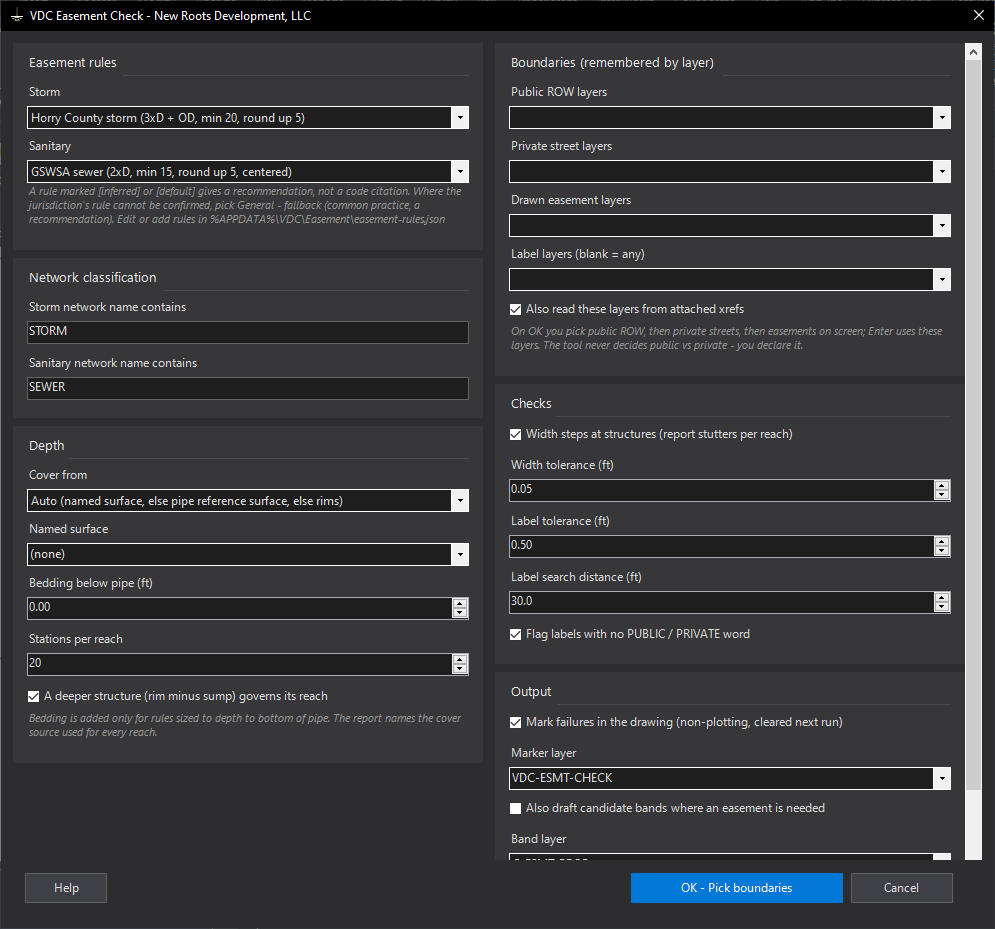
VDCESMTCHECK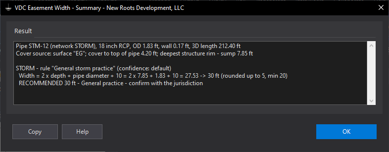
VDCESMTWIDTHSettings file:
%APPDATA%\VDC\Easement\audit-settings.json | %APPDATA%\VDC\Easement\easement-rules.json | %APPDATA%\VDC\Easement\settings.jsonWhen to use it
- Before submittal or plat recordation, on any set with storm or sewer easements.
- When an easement width was carried over from a previous job.
- Inside private streets, where 'the sewer is in the road' still needs an easement.
How to run it
- Run VDCESMTCHECK; pick the storm and sanitary rules (General - fallback where the jurisdiction's own rule cannot be confirmed) and check the network words.
- Choose the area (Enter = whole drawing).
- Pick the public right-of-way boundaries, then the private street boundaries, then the drawn easements (Enter each time = the layers remembered from last time).
- Read the summary, then work the palette rows; double-click zooms to the worst station.
Options
- Cover from: Auto, the pipe's reference surface, a named surface, or the structure rims.
- Bedding: added for rules sized to the bottom of pipe (GSWSA).
- Width steps at structures: off = every reach held to its run's governing width.
- Mark failures: circle + note at the worst station on a non-plotting layer, cleared next run.
- Draft candidate bands: straight-sided bands squared at the public ROW, never parcels.
Watch out for
- Easements drawn as two parallel lines are measured in 'degraded' mode - closed polylines measure best.
- A label is matched to the easement it sits in or points into; a label far from its easement is missed.
- Drafted bands are a drafting aid - verify against the plat before use.
- The CSV's WidthStatus column says Required, Recommended or Recommended - general fallback; the palette writes req or rec before the width.