01
Plan Review & QC
Pre-submittal third-party QC against the agency's actual checklist. CAD standards compliance, cross-sheet consistency, and the corrections you would rather catch before the reviewer does.

An Autodesk® Civil 3D® command suite and a plan review practice, built by a designer who still produces plan sets every week. For AEC firms that need the work to hold up at the agency counter.
Production, review, and standards work across land development in the Carolinas.
Licensed drone operation for topographic mapping and as-built capture.
Published Civil 3D author and former Director of the AUGI Civil 3D Community.

Seven ribbon tabs. Most of it drafts, the rest audits. All of it runs on your firm's standards.
Plan production, pre-submittal QC, quantities, and drone capture, delivered to your standards and behind your PE or PLS of record.
Five services, all of them things I do on live projects every week.
Pre-submittal third-party QC against the agency's actual checklist. CAD standards compliance, cross-sheet consistency, and the corrections you would rather catch before the reviewer does.
Bid-ready quantities and earthwork analysis pulled from the model, not scaled off a PDF. Independent verification for when the number has to be defensible.
We produce plans and plats. Full civil site plan sets and recorded plats, drafted in Civil 3D software to your template and your layer standards, delivered behind your licensed PE or PLS of record.
Styles, label sets, part lists, and project templates built to your firm's standards, so the drawing comes out right before anyone starts drafting.
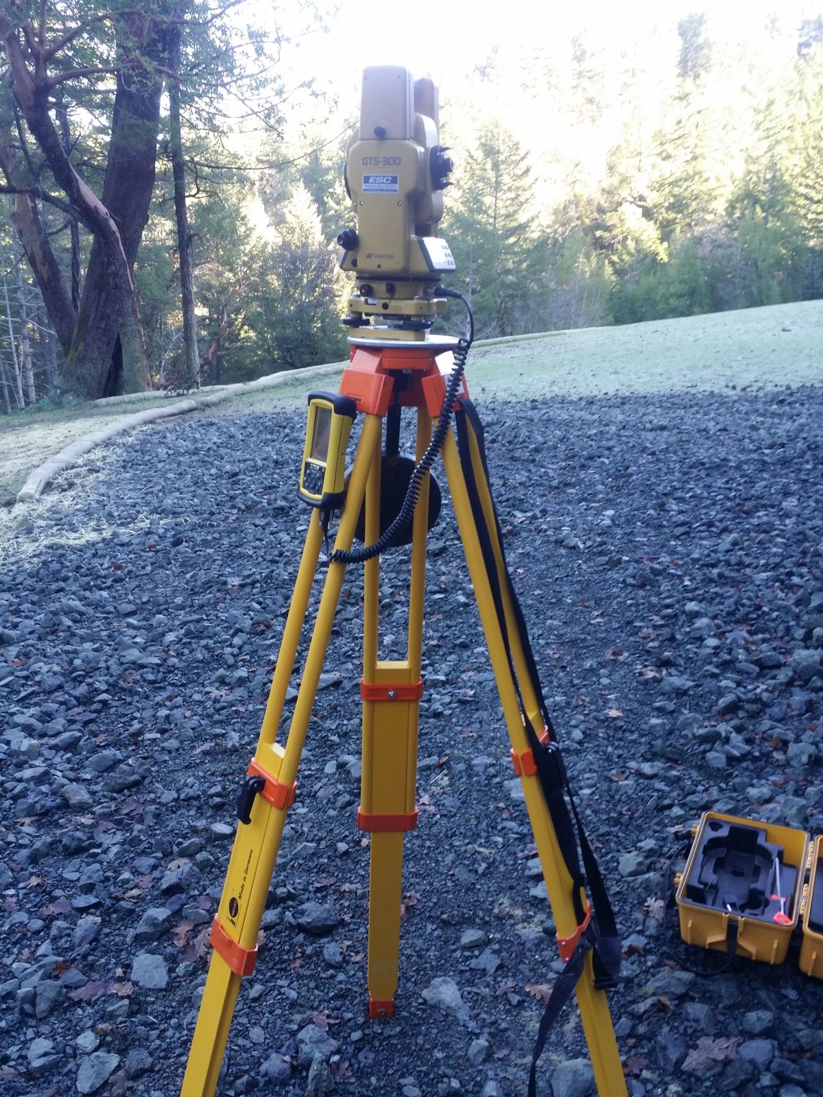
Existing-conditions surfaces flown, processed and delivered ready to model in Civil 3D software. Flown by an FAA Part 107 remote pilot who is also trained in drone maintenance through Horry-Georgetown Technical College and the Unmanned Safety Institute.
Seven ribbon tabs and twenty-three panels. Civil, Lots, Utilities, Survey, Sheets, Plans draft: lot grading, lidar ground thinning, contour smoothing, service laterals, storm and sewer layouts, adjoiner labels, sheet frames. VDC QC reviews: zoning minimums, pipe cover and slope, road geometry, ADA slopes, plat closure, plotted-label collisions. Standards live in editable libraries, so every audit runs against your rules.
I'm Christian Barrett. Twenty-five years in civil engineering, and I still produce plan sets, run reviews, and fly the sites underneath both. New Roots exists because the tools I needed did not exist, so I built them. Everything here comes out of production work, not a product roadmap.
Seven ribbon tabs. Twenty-three panels. Everything from rough lot grading and storm layout through zoning audits, plotted-label collision checks, and pre-recordation plat QC.


Every tab exactly as it loads on a 1920-wide screen. Built in-process, so there is no CUIX to install, and they re-add themselves after a workspace switch.
Grading, Feature Lines, Terrain and Hydrology. Rough lot grading with live pad labels, the feature-line tools, lidar thinned down to ground shots, point-cloud slabs and assets, USGS terrain, and the drainage prep: catchments, time of concentration, curve numbers, stage-storage.
Lots, Parcels and Labels. Lot fronts stamped once so every other lot tool knows the frontage, setbacks, service laterals that restretch when a main moves, front easements, the parcel family, and plan labels that stay live.
Pipes, Profiles and Drawing Tools. Storm and sanitary draft layouts, pipes named by run, profile views built from runs, crossings labeled in plan and profile, band profiles, and the everyday drawing tools.
Adjoiners + GIS, Points and Boundary + Plats. Adjoiner labels pulled from the county GIS, buffer yards, wetlands, soils, terrain, KML and GIS file exchange, stake-out, control, deed tables, legal descriptions, and plat QC.
Sheets, Sheet Sets and Sheets + Takeoff. A sheet-frame system that makes sheet 4 of the grading set cover the same ground as sheet 4 of the utility set, sheet set numbering, mirroring and sharing, plot batches, the sheet index, label collisions as they actually plot, viewport QC, and quantity takeoff.
Plans, Tables + Reports, Coordination and Closeout. Cover fill and the flood note, lot and pipe tables, station-offset and haul reports, drawing locks, plan review email, and the as-built closeout tools.
Site QC, Design QC and Drawing QC. The reason this is not just another drafting plugin. Lots against zoning minimums, pipes against cover and slope standards, roads against design-speed geometry, ADA slopes, sight triangles, hydrant coverage, clashes, flood, drawing standards, styles, xrefs, and who did what.
No summary, no highlights reel. This is what you get, straight out of the ribbon. Filter it.
| VDCGRADELOTS | Auto-Grade Lots. Drafts shared side feature lines on each property side line and a flat pad feature line over the building setback for every selected lot, then adds the whole batch to the proposed lot grading surface as breaklines in… |
| VDCGRADELOTS_REFRESH | Refresh Lot Elevations |
| VDCREFRESHALL | Refresh All (elevations + labels). Chains the three after-regrade refreshes into one command: the AutoGradeLots elevation re-pull, the feature-line label refresh, and the pad-label refresh, so a design-surface change is carried through every VDC grading… |
| VDCGRADELOTS_RESURFACE | Reassign Source Surface |
| VDCSMOOTHSURF | Smooth Surface (fix wavy contours). Fixes wavy (squiggly) TIN contours by editing the surface , not the picture: wavy spans are detected on test contours, then Minimize Flat Areas + region-limited Natural Neighbor (NNI) smoothing are applied as ordinary… |
| VDCDRAINARROW | Drainage Arrows + Flow Paths. The drainage arrows drafters place by eye, computed from the surface. |
| VDCFLPOINTS | Feature Line Elevation Points. Adds elevation points along feature lines: tangents and curves each at their own spacing (defaults 10 ft / 5 ft ), and either type can be turned off . Set the spacing and elevation source once, then pick feature lines… |
| VDCFLDELVERTS | Delete Feature Line Points (windowed). The feature-line counterpart of VDCDELVERTS: windows an area and deletes the feature line points inside it - PI points (reshapes the line in plan), elevation points (drops grade breaks, plan shape unchanged), or both.… |
| VDCFLFROMPTS | FL from Points (elevations from COGO points). The field crew shot the grade breaks; the linework is still flat. VDCFLFROMPTS selects lines, polylines, and feature lines and gives every vertex the elevation of the COGO point sitting on it (nearest within a set… |
| VDCFLCONNECT | Connect Points into a Feature Line. Builds one feature line through COGO points at their elevations - connect the dots, in the order you choose. Pick points on screen one after another, type N to add a point-number range the way the 'PN transparent… |
| VDCGROUNDTHIN | Ground Thin (lidar to ground shots). Thins a lidar/point-cloud export down to probable ground shots: per grid cell, the lowest point survives plus everything within a keep band above it; a despike guard rejects spurious low returns; classified LAS can be… |
| VDCCLOUDSLICE | Cloud Slice (point-cloud slabs to linework). Slabs to linework: slice a LAS file at elevations, at heights above a TIN, or along a polyline / alignment; the points in each slab become polylines on a layer per slice. Every extraction number is in the dialog. |
| VDCCLOUDASSETS | Cloud Assets (poles, signs, trees, hydrants from a point cloud). The vertical stuff in a cloud: a height band above the ground, plan clusters, a PCA per cluster gated to Pole / Sign / Tree / Hydrant with editable thresholds, a density check first, a review table before any block is… |
| VDCTERRAIN | Terrain (USGS 3DEP surface + compare). An existing-ground surface from USGS lidar in one pick, and a check of how far a drawing surface is from it. Build samples the USGS 3D Elevation Program DEM on a grid and creates a TIN surface; Compare samples a… |
| VDCDRAINAGEAREA | Drainage Area (catchment delineation). The drainage-report prep family, straight from the graded surface: delineate the catchment of a picked outlet by flow tracing on the TIN, run TR-55 travel times along its longest flow path, weight the curve number from… |
| VDCTC | Time of Concentration (TR-55). TR-55 chapter 3 without the worksheet: the path is sampled on the surface, split by length into sheet flow (first 100 ft by default), shallow concentrated flow and channel flow (last N ft), each segment's slope comes… |
| VDCCN | Curve Numbers (composite CN per drainage area). Draw the land cover as closed polylines on their own layers (impervious, lawn, woods ...), map each layer to a cover class in the dialog, and the tool intersects every drainage area with the soil polygons and the cover… |
| VDCSTAGESTORAGE | Stage-Storage-Discharge (pond). Elevation-area-volume from the pond surface at every stage from the bottom to the top of bank: the exact volume under the TIN, plus the average-end-area and conic columns that match Civil 3D's own stage-storage report.… |
| VDCLOTFRONT | Designate Lot Fronts. Designates each parcel's front edge once and stamps it on the parcel (readable through xrefs), so every VDC lot tool skips its per-lot "click the front edge" prompt on a whole plat. |
| VDCSETBACK | Parcel Setbacks. Generates building setback lines inside selected lots from front / side / rear setback values. Also available as PARCELSETBACK. |
| VDCSERVICELOTS | Service Lots. Places water and sewer service blocks at the front corners of subdivision parcels. Two modes: Singles (one block per corner, two per lot) and Doubles (one shared DBL block per lot, alternating water/sewer across picks). |
| VDCSERVICESTRETCH | Stretch Services to Mains. The second half of Service Lots. Where VDCSERVICELOTS puts the blocks at the front lot corners, this stretches each block's LATERAL - the line representing the pipe running out to the main - until it actually meets… |
| VDCFRONTEASE | Front-Lot Easements. Draws a closed front-lot easement strip along the FRONT edge of every lot at once (default 10 ft into the lot): the front-only, all-lots counterpart to Setback Lines. The front edge comes from VDCLOTFRONT , so there is… |
| VDCPARCELGEN | Create Parcels from Linework. The parcel family: bulk creation, ROW that follows the road, auto-subdivision, and the sharing data shortcuts never got. |
| VDCROWGEN | Right-of-Way from Alignments. Builds right-of-way parcels FROM alignments - and remembers how. Each picked alignment is sampled, offset left and right by the widths, and closed with a square cap or a TRUE cul-de-sac bulb (the ROW edges trim exactly… |
| VDCLOTSPLIT | Auto-Subdivide a Block. Auto-subdivision: picks the maximum number of conforming lots out of a block parcel per a zoning preset - and it uses the SAME preset library as VDCLOTQC, so what this lays out, that audit passes by construction. The… |
| VDCPARCELREGEN | Regenerate Stale ROW. The reactive half of the parcel family: every ROW recipe re-hashes its driving alignment, and the sites whose roads moved rebuild - cleared, regenerated from current geometry, restyled, restamped, hashes refreshed.… |
| VDCPARCELPUB | Publish Parcels for Sharing. Half one of parcel sharing - the thing data shortcuts still can't do in 2027. Publishes parcels to a portable package: boundary geometry as true bulge segments in world coordinates, name, number, style, and a… |
| VDCPARCELREF | Reference Published Parcels. Half two of parcel sharing: rebuilds a published package as REAL Civil 3D parcels in a quarantined VDC-REF site. Because they are real local parcels, they label natively (no xref-label instability), styles resolve… |
| VDCPARCELNUM | Sweep Renumber Parcels. Sweep renumbering: the native renumber is pick-one-at-a-time; this takes a whole site (or a picked set) and renumbers it the way a person reads a plan - rows grouped top-to-bottom by a tolerance, left-to-right, with… |
| VDCPARCELQC | Parcel Topology Audit. Read-only topology audit - finds what makes parcels blow up BEFORE they blow up: sliver parcels under your area threshold, micro boundary segments, duplicate numbers within a site, boundary overlaps between parcels… |
| VDCPARCELXPORT | Parcels to Polylines and Back. Parcels to polylines-with-memory, and back. Export writes every parcel boundary as a closed polyline with TRUE arc bulges on a layer, carrying name/number/style in XData - for surveyors, plat drawings, plain-CAD… |
| VDCPARCELPROBE | Parcel Creation Diagnostics. Diagnoses the parcel-creation bridge VDCPARCELGEN runs on: are the Civil COM interop assemblies loadable, does the Civil application object resolve, is the active document reachable, and what does every site hold… |
| VDCFLLABEL | Label Feature Lines. Batch-labels every feature-line segment on a chosen layer with its slope and optionally point elevations: at the first and last point, at every PI , at every PI plus every elevation point , or at the elevation points… |
| VDCPADLABEL | Label Pads. Finds every pad feature line that VDCGRADELOTS stamped and labels it with the lot name, the pad elevation, and an optional minimum-FF line: no picking. v1.34+: the label is a native surface spot-elevation label on the… |
| VDCLABELDRAG | Drag Network Labels. Pulls pipe network structure labels (and pressure fitting/appurtenance labels: hydrants, tees, bends, valves) off the road into the lots , the way a drafter drags them one by one after auto-labeling a network. Moving… |
| VDCLABELFIX | Label QC + Auto-Drag. The QC-then-auto-clear combo : Label QC's plotted-collision scan finds the pileups, Label Drag's engine drags the colliding network labels clear , a re-check reports what's left for hand cleanup. |
| VDCMTEXT2MLDR | MText to Leader. Converts selected MText into multileaders: the text stays exactly in place and only gains a leader; contents, inline formatting, height, style, layer, color, mask, rotation, and annotative state all carry over. The… |
| VDCCODELEADER | Code Leaders (label survey points). Batch-creates multileaders on survey COGO points by field code . The drawing's codes come up as a check-list: IPF (12), IRON PIPE FOUND, and every checked code gets a leader per point: the code and/or its spelled-out… |
| VDCKEYNOTE | Keynotes + Sheet Legend. Keynotes as a managed system, not loose leaders. |
| VDCCURBRADII | Curb Radii. Curb return radius call-outs on plain polylines and arcs (curbs that are not feature lines): one R=25.00' per arc at the arc midpoint, pushed outward so it clears the curb. Plain AutoCAD throughout, the vanilla seats… |
| VDCTCBC | TC / BC Labels. Top-of-curb / bottom-of-curb pairs along picked curb lines: every N ft and/or at every vertex. With a Civil 3D surface the TC is a live spot elevation label and BC = TC − curb height; without one (or on plain AutoCAD)… |
| VDCPIPELABEL | Label Pipe Crossings. Auto-labels every cross-discipline pipe crossing in the host drawing (storm/sewer/water/forcemain: all six pairwise combinations) in plan view AND in every applicable profile view. One annotative MLeader per crossing… |
| VDCPIPEREF | Pipe Ref. Assigns a reference alignment to each gravity pipe run: grouping connected pipes and structures, projecting the run onto every alignment, and setting RefAlignmentId on the lowest-mean-offset qualifier so station-based… |
| VDCPIPEVIEWS | Pipe Views. Turns gravity pipe runs into finished profile sheets in one command : detects every branch-free run, then per run creates the alignment through its structures, samples EG + FG surface profiles , builds the profile view… |
| VDCPIPENAMES | Pipe Names (by run). Auto-names gravity structures and pipes by run : the longest run is A , its structures A1, A2, A3 , its pipes A1-A2, sewer gets the dash format ( A-1, A-2 ), from configurable templates, with an old→new preview before… |
| VDCPROFXING | Profile Pipe Crossings QC. Audits every alignment's profile views for pipes that cross the alignment but aren't drawn in the view (or aren't on the crossing style), and can auto-draw each missing crossing into its correct profile view: the… |
| VDCSTORMDRAFT | Storm Draft (starting point). Two draft-quality layout generators : pick a road alignment + its design profile and get a starting-point network, storm (sag inlets + trunk) or sanitary (manholes + main), with rule-based inverts. A DRAFT to refine… |
| VDCSEWERDRAFT | Sewer Draft (starting point). Drafts a STARTING-POINT sanitary layout - not a design, and every number is an ASSUMPTION surfaced in the dialog. Manholes land at both alignment ends, at every horizontal geometry point (sewer pipes run straight… |
| VDCPROFLINE | Profile Elevation Line (NWL / BFE / weir). Draws a horizontal elevation line across picked profile views: the pond NWL, a BFE, a weir crest, at a typed elevation, extended a chosen distance past each side of the view. NWLs stay visible in profiles without… |
| VDCSURFPROFILES | Batch Surface Profiles. Batch Create Profile from Surface. The stock dialog adds the surface to one alignment at a time: add, OK, next view. This samples a chosen surface (existing ground) into a dynamic profile for every in-scope alignment… |
| VDCBANDPROFILES | Band Profiles (existing + proposed). Existing + proposed into every profile view's bands. When Civil 3D creates a profile view, the band set's two profile slots default to the same profile twice: so the elevation band shows one elevation in both label… |
| VDCPROFHPLP | Profile HP / LP Labels (in plan). The office's HP / LP call-outs in plan : every high and low point of an alignment's profile gets a two-line multileader, HP: 44+25.00 over ELEV: 45.47, with the arrow on the alignment point and the text offset to a… |
| VDCOFFSET | Multi-Offset. Gang-offsets one source: an AutoCAD curve or a Civil 3D alignment, to a whole plan-section template in a single shot: up to 6 parallel copies per side , each row a distance + its own layer, fired out from a reusable… |
| VDCEASEMENT | Easement Widths. Computes the required storm / sanitary easement width for every gravity pipe from its depth-to-invert and the controlling jurisdiction rule, reports each pipe to a CSV + the findings palette, and in Generate mode draws… |
| VDCFHSPACE | Place Hydrants. Drops hydrant marker blocks along a road alignment at fixed station spacing (typical 400 ft residential, 500 ft commercial). Markers are placeholders: they get replaced by real fire-hydrant parts when the pressure… |
| VDCDELVERTS | Delete Polyline Vertices (windowed). Window an area: the vertices inside it go away. The window-based version of picking vertices off one at a time in the grip editor: set the scope once, then window areas one after another; each pass is one undo step.… |
| VDCSCANDWG | Drawing Scan (issue scanner). The cleanup macro as real commands: duplicates + zero-length erased (native MAPCLEAN-action implementations, Civil 3D objects never candidates), audit with fix-errors on, ACA data purge ( AECCPURGEACANODOBJECTS )… |
| VDCCLEANDWG | Clean DWG (one-click cleanup). The drawing cleanup most users run as a hand macro - when they know action macros exist at all - as one command. Erases exact duplicates (same type, layer, geometry within tolerance; the OLDEST copy survives) and… |
| VDCSUPERCLEAN | Super Clean (deep cleanup). Everything in Clean DWG, wrapped in the deep-clean order: the Civil 3D styles purge runs FIRST, back-to-back (default 3 runs - an unreferenced parent style only becomes purgeable after its child styles purge, which is… |
| VDCSTYLEUPDATE | Style Update (batch style + settings import). The batch form of the Manage tab's Import Civil 3D Styles . Civil 3D ships that feature as a dialog and nothing else: no command-line form, no managed API, so it does one drawing at a time and cannot be scripted or… |
| VDCEXPORTCAD | Export plain AutoCAD (flattened). Exports a plain-AutoCAD copy with every Civil 3D object exploded, flattens it to Z = 0 so design elevations do not leave with the file, purges it, and then re-measures the result to confirm nothing AEC or proxy… |
| VDCXREFFIX | Repair Xref Paths. The fix side of xref health. |
| VDCLAYERMAP | Translate Layers to a Client Standard. LAYTRANS, batch-grade, with the mapping as per-client data. |
| VDCADJLABEL | Adjoiner Labels. Labels the subject parcel and every adjoiner: the plat "now-or-formerly" block, from the county's live public GIS parcel service , dropping a formatted MText at each parcel's centroid with PIN / TMS / owner / deed… |
| VDCADJPARCELS | Adjoiner Parcels (boundaries only). The boundaries-only sibling of VDCADJLABEL. Same live county GIS pull, but instead of a label at each centroid it draws each parcel's actual boundary as a closed 2D polyline. Use it when you want the adjoining parcel… |
| VDCADJTAG | Adjoiner Tags. The companion to VDCADJLABEL for the sliver lots too small to hold their label : swaps each cramped label for a tag, a numbered/lettered circle or plain "Lot N" text, and moves its contents into an "Adjoining Tax… |
| VDCBUFFERYARD | Landscape Buffer Yard. Resolves the landscape buffer required along every edge of the subject parcel : adjoiners + zoning from the county's live GIS, each perimeter stretch attributed to the neighbor it faces, widths from your editable… |
| VDCWETLAND | Generate Wetland Areas. Generates wetland areas two ways: pulls every National Wetlands Inventory polygon in a picked window from the live USFWS service (planning-level limits, already in the drawing's State Plane grid), or connects the… |
| VDCSITEDATA | Site Data (pull public GIS into the drawing). Everything public about a site, pulled into the drawing in one pick. VDCSITEDATA lists every live public source that applies to the drawing's location: flood, wetlands, soils with hydrologic group, lidar terrain… |
| VDCSITESNAPSHOT | Site Snapshot (one point, one page). The due-diligence sheet that used to be a dozen browser tabs. Pick one point and every public service is asked what is there: parcel and owner, zoning and overlays, flood zone and panel, wetlands, soils with hydrologic… |
| VDCKMLEXPORT | KML / KMZ Export (Google Earth). Drawing linework to Google Earth and back. Export picked entities to a KML / KMZ in WGS84, one folder per layer in the layer's color; import a KML / KMZ onto KML-<folder> layers. Positions through the suite's… |
| VDCKMLIMPORT | KML / KMZ Import. Brings Google Earth or GIS KML into the drawing: every folder becomes a layer (prefix KML-, color from the folder style), paths become polylines, polygons closed polylines, placemarks points with an optional name… |
| VDCSHPIMPORT | GIS Import (Shapefile / GeoJSON / KML). GIS files in and out without a GIS seat: import a Shapefile, GeoJSON or KML through a layer-rule grid in the drawing's coordinate system, and write the GIS as-built deliverable from an editable jurisdiction profile as… |
| VDCGISEXPORT | GIS Export (as-built deliverable). The GIS as-built deliverable without the GIS seat: a profile JSON says what the jurisdiction wants - for each output layer, the source (Civil pipes, structures, pressure pipes, pressure parts, parcels, or the entities… |
| VDCGISINFO | GIS Info (attributes on a picked object). Every GIS tool now attaches the feature's attributes to what it draws - the county's parcel fields on the parcel polyline, the map unit facts on the soil ring, the NWI code on the wetland limit, the placemark's… |
| VDCSOILS | Soils (USDA map units with hydrologic group). USDA soil map units with hydrologic soil group, as a finished exhibit. One window: SSURGO map units clipped to it, solid-hatched by hydrologic group, labeled, tabulated with an HSG breakdown and total, and exported to… |
| VDCSTAKEOUT | Generate Construction Stake-Out. Construction stake-out, generated and verified. VDCSTAKEOUT creates the offset stake COGO points from the design with the crew's own description conventions ( cl/A-3 , 15os/A-3 , 3' os tbc , sws / sss ); VDCSTAKEQC… |
| VDCSTAKELOTS | Stake Lots. Drops Civil 3D COGO points at the four lot corners (FL, FR, BL, BR) and the lot centroid (CTR). Shared corners between adjoining lots get combined labels naming both parcels (e.g. 16F/17F , 16B/17B ); boundary corners… |
| VDCDEDUPPOINTS | Remove Duplicate Points. Finds coincident COGO points: the classic double-imported point file, and erases the higher-numbered duplicates, keeping the lowest point number at each location. |
| VDCCONTROL | Control Exhibit. The survey control table and grid-tie note, from the points themselves. |
| VDCNGSCONTROL | NGS Control (published survey marks). Published NGS survey control into the drawing, ready for the control exhibit. Every published mark in the picked area from the NOAA National Geodetic Survey datasheet API → COGO points in a point group with datasheet… |
| VDCFIGURES | Field-to-Finish Linework. Connect-the-shots, straight from the COGO points. |
| VDCDEEDTABLE | Deed Table. Walks a picked parcel boundary and builds the metes-and-bounds LINE and CURVE tables: each straight side becomes an L# row (quadrant DMS bearing + distance), each arc a C# row (radius, delta, arc, chord bearing… |
| VDCTAGLABELS | Create / Renumber Line/Curve Tags. Creates and renumbers L#/C# line and curve tag labels: the tags line/curve tables read; the tag letters are configurable for other conventions (LN12, CU-3, T4), from one dialog, with the start numbers where you can see… |
| VDCPLATQC | Plat QC. Pre-recordation plat audit: recomputes each boundary's traverse closure from the rounded table values against a 1:10,000 standard, then audits COGO point numbers, flags probable N/E transpositions , and scans text for… |
| VDCLEGAL | Legal Description (metes and bounds). The metes-and-bounds narrative, the way it reads on a deed , from a Civil 3D parcel or a closed polyline: a commencement tie, one thence per course, curve calls with radius / arc / chord, and the closing area. A draft… |
| VDCFRAMEDEF | Define Sheet Frames. One master set of sheet frames per project , shared by every discipline drawing through a project frame file: so sheet N covers the same ground on the grading plan, utility plan, and E&S plan. VDCFRAMEDEF computes the… |
| VDCSHEETGEN | Generate Sheets from Frames. Generates this drawing's sheets from the shared frame file so every plan set's sheet N covers identical ground. The default aim-only mode clones your template layout once per frame and sets ONLY the existing viewport's… |
| VDCPLOTBATCH | Plot Batch (layouts to named PDFs). The submittal folder in one run: every layout to a PDF named <sheet number> - <sheet title>.pdf (sheet set first, title block second, layout name last), one per sheet or one merged set, after a pre-flight that catches… |
| VDCPHASING | Phasing (per-phase layouts, layer states, quantities). Phasing without redrawing the set: entities carry their phase as XData (by pick or by layer); Generate makes a layer state and a layout per phase with the other phases screened gray or frozen, and a quantity tally per… |
| VDCSHEETPATH | Batch Re-Path Sheet Set Layouts. The Sheet Set Manager family: re-path, renumber, audit, derived sets, shared sheets. A sheet's identity lives in three places at once, the set's number, the layout tab, the title block, and these keep the three together. |
| VDCDISPSTYLES | Display Plot Styles (all layouts). Sets the Page Setup “Display plot styles” checkbox on every paper-space layout at once , instead of opening Page Setup on each tab in turn. It is a display setting: whether a layout draws through the plot style table… |
| VDCREVCLOUD | Auto Revision Clouds. Draws the revision clouds a drafter draws by hand after a revision. |
| VDCLEGEND | Legend Audit + Generator. Keeps the legend honest: and draws it. |
| VDCTITLEQC | Title Block Audit + Sync. One read of every sheet's title block, both directions. |
| VDCSHEETNUM | Batch Renumber and Rename Sheets. Renumbers a whole sheet set in one pass and moves all THREE copies of each sheet's identity together - the sheet set's number, the drawing's layout tab, and the title block. Natively those three drift apart the first… |
| VDCSHEETQC | Audit Sheet Numbers vs Layouts vs Title Blocks. Read-only audit of the three places a sheet's identity lives. Flags duplicate sheet numbers, missing drawings, missing layouts (the sheet won't open from SSM), layout tabs that stopped carrying their sheet number… |
| VDCSHEETMIRROR | Derived Sheet Sets Synced from a Master. Derived sheet sets that stay stocked from a master. A permit subset, bid set, or phase set is just a saved selection over the master's sheets: check what the derived set carries and every sync flows adds, removals, and… |
| VDCSHEETSHARE | Add Existing Layouts to a Sheet Set. Adds existing layouts to a sheet set, including layouts that already belong to ANOTHER set - the standard-details and general-notes case, where one sheet serves several sets. The Sheet Set Manager UI refuses that… |
| VDCSHEETSTAMP | Same Items, Same Place, Every Sheet. The same items, in the same place, on every sheet: the "paste the seal block on all 40 sheets" command. |
| VDCSHEETINDEX | Sheet Index + Viewport Audit. Builds a naturally-sorted sheet index from the paper-space layout tab names (parsing sheet number + title), then audits each layout's viewports for non-standard scales, rotated views, missing viewports, bad match-line… |
| VDCLABELQC | Label Collision QC. Finds overlapping labels as they actually plot: projecting every model-space annotation through each layout viewport's twist & scale into paper space, then flagging pairs whose plotted boxes overlap by more than a… |
| VDCVIEWPORTQC | Viewport QC. Read-only audit of every paper-space viewport and page setup for plot-production readiness: unlocked viewports, annotation-scale ÷ viewport-zoom mismatch, off/orbited views, per-viewport layer overrides, and each… |
| VDCQTO | Quantity Takeoff. Extracts construction quantities scan-then-pick: one discovery scan of the host drawing and its xrefs finds every layer of linework (incl. feature lines, LF), every hatch and closed-polyline layer (SF), every block… |
| VDCESC | Erosion-Control Quantities. Tallies erosion & sediment-control quantities from objects on the ESC layers: total disturbed acreage, linear items (LF) and count items (EA), and compares the disturbed area to the NPDES permit trigger . |
| VDCTREETABLE | Tree Table. Builds the landscape-ordinance tree preservation / mitigation table from the survey: parses species and DBH out of tree-point descriptions, marks trees inside the limits-of-disturbance polylines as removed , classifies… |
| VDCREVTABLE | Rev Table. Inventories every revision cloud and delta triangle across model space and every layout, pairs each cloud with its delta tag, and flags the clouds nobody wants to miss at resubmittal: orphans with no delta and stale… |
| VDCCOVERFILL | Cover Sheet Fill. Fills the PROJECT SUMMARY cover-sheet block in place: acreages, the impervious/pervious breakdown with percentages, CL road length, and lot counts, tallied live from the drawing, by matching each label line's wording… |
| VDCFIRM | FIRM Flood Note. Fills the flood-zone note from live FEMA NFHL data: the zone(s) intersecting the property, the F.I.R.M. panel number + suffix , and the panel effective date, swapping only those three spans so the standard wording… |
| VDCLOTTABLE | Lot Table. Exports a per-lot summary: area (SF & acres), frontage, depth, width at the setback, and live pad elevation, as a natural-sorted CSV (always) plus an optional AutoCAD table placed in the drawing. |
| VDCPIPETABLE | Pipe Table. Builds the construction-plan PIPE SCHEDULE and STRUCTURE SCHEDULE for every pipe network in one command: natural-sorted ( STM-2 before STM-10 ), grouped per network, with flow-oriented inverts, plus an always-on CSV.… |
| VDCSOTABLE | Station-Offset Table. Tabulates numbered callout multileaders and/or COGO points by station and offset against a reference alignment: anchoring on the multileader arrowhead or the point, reading the key from bubble text / point description… |
| VDCHAUL | Earthwork Haul. Turns a volume surface (or a manual cut/fill entry) into an earthwork haul estimate: applies soil swell/shrink to net cut against fill, then reports the net export/import and the truck loads to move it, live in a… |
| VDCBALANCE | Cut/Fill Balancer. “How far up or down does the whole site move to balance?”: answered before anyone regrades. |
| VDCLOCKS | Drawing Locks (who's open). Reads the .dwl / .dwl2 lock sidecars AutoCAD writes beside each open .dwg to show which drawings are currently open and who has them: before you open them, without opening a single file. |
| VDCGEOREF | GeoRef (coordinate system + units audit). Which coordinate system and units is this drawing in, and do its xrefs agree? One dialog answers it and flags what is wrong; Assign fixes it only on OK; a one-line note appears when a saved drawing opens with a problem. |
| VDCDSQC | Data Shortcut QC (read-only). Is the data-shortcut web healthy? One read-only run over the project's published shortcuts and this drawing's data references: missing sources, broken and out-of-date references, orphaned shortcuts, in the QC palette… |
| VDCPLANEMAIL | Plan Review Email. Drafts a plan-review submission email in Outlook or the OS default mail app: recipient, subject, and plan-set reference filled the same way every time from the open drawing's project; the draft is displayed for review… |
| VDCERROREMAIL | Email My Error Reports. One click after Civil 3D crashes: finds your Autodesk error-report store, packages the most recent reports (default 3 - the full store runs hundreds of MB and can never be emailed whole), and drafts an email to your… |
| VDCASBUILT | As-Built / Record Drawing. Moves an approved design drawing toward the record-drawing deliverable in four independent, individually-skippable actions: ghost the design layers, stamp every layout, compute as-built-vs-design deltas , and drop an… |
| VDCSETINVERTS | Set Inverts from Survey Points. Writes coded as-built survey shots onto pipe-network structures : window the surveyed area, and every COGO point with a recognized field code pairs with the nearest structure in the window, the shot's elevation lands… |
| VDCBUILDSTRUCTS | Structures from Survey Points. Creates real gravity-network structures from coded existing-structure survey shots : the mapping grid turns each field code into a network + part family + size , window the surveyed area, and every mapped point becomes… |
| VDCBUILDPIPES | Pipes from Destination-Coded Shots. Draws real gravity pipes from destination-coded as-built shots ("SSMH INV TO MH 3"): the last step of the field-to-finish chain: VDCBUILDSTRUCTS creates the structures, VDCSETINVERTS loads them, this connects them . |
| VDCSTAKEQC | Stake-Out QC. Answers 'is the stake set right?' by reading each point's description as a claim and verifying it against the design: cl/A-3 must sit at structure A-3, 15os/A-3 at 15' from it, 3' os tbc at 3' off the curb line… |
| VDCLOTQC | Lot QC. Audits picked subdivision lots against a zoning district's dimensional minimums: area, frontage, depth, width at the front setback, and side-line squareness, then drops a red QC FAIL flag at the centroid of every lot… |
| VDCLOTDRAINQC | Lot Drainage QC (finished-grade surface). The plan reviewer's walk around every lot, read from the finished-grade surface: ground falling away from the house, side swales falling from their high point along the side lines, the pad above the street, and no… |
| VDCPARKING | Parking Count + Ratio. Counts standard / ADA / van stalls from block references and closed polylines on the parking layers, computes the required supply from a zoning ratio (or a manual override), and audits the accessible & van counts… |
| VDCPARKINGDIM | Parking Dimensions (meets code). The dimensional half of "does the parking meet code": measures each parking-stall block's drawn footprint and flags any stall smaller than the minimum for its class (Standard / ADA / Van). Sibling of VDCPARKING in the… |
| VDCADASLOPE | ADA Slope Audit. Samples the proposed surface across closed polygons on the ADA layers: stalls, aisles, landings, and routes, fits a plane to each region, and flags any slope that exceeds the ADAAG limits. |
| VDCFIRECOVER | Fire Hydrant Coverage. Flags building footprints whose farthest boundary vertex lies beyond the coverage radius of the nearest fire hydrant: straight-line distance, per fire-protection review. |
| VDCSIGHTDIST | Sight Distance. Draws the AASHTO intersection sight triangles for a minor approach onto a major road from one pick: departure sight distances from design speed × time gap, legs running up- and down-station along the alignment, then… |
| VDCTREECLEAR | Tree / Utility Clearance QC. Tree vs utility clearance QC: the spec everyone has and nobody checks. |
| VDCPIPEQC | Pipe Network QC. Audits gravity & pressure pipe networks against a design-standards preset: buried open ends, adverse inverts, short drops, uphill flow, slope-by-diameter, cover / out-of-ground / depth, material bands and rim, and… |
| VDCROADQC | Road QC. Audits selected road alignments and their finished-ground profiles against design-speed-keyed geometric standards: min curve radius, min/max grade, crest/sag K, vertical-curve length, and grade breaks, then flags each… |
| VDCSURFQC | Surface QC. Audits a TIN surface for drainage and data problems: computes each triangle's max slope from its plane normal, flags flat triangles (ponding / flat spots) and spike triangles (bad survey points), and reports surface… |
| VDCCLASH | Pipe Clash Check. Checks every plan-view crossing between pipe networks for adequate vertical clearance: outer-wall-to-outer-wall gaps that are negative are conflicts (ERROR); gaps below the required discipline-pair separation are… |
| VDCFLOODQC | Flood QC. Pulls the live FEMA National Flood Hazard Layer zones intersecting the checked area: in the drawing's own State Plane coordinates, labels each zone with its published BFE, optionally draws the boundaries, and checks… |
| VDCPONDQC | Pond / SCM Geometry QC. Pond/SCM geometry QC: three checks against criteria you enter, one boundary pick. |
| VDCSTDQC | Standards QC. Audits drawing-standards conformance : every text style's resolved font against the expected annotation font ( Tahoma ), and every layer's ACI color against the seeded plotted-color palette, flagging the strays in a… |
| VDCSTYLEAUDIT | Style QC. Audits the provenance of every Civil 3D style in the drawing: reads each style's Last Modified By from its Information tab and flags any style not last-modified by an authorized modifier (a configurable list, default =… |
| VDCXREFQC | Xref QC. One read-only command audits the drawing's whole reference web: xref definitions from the block table and host graph plus every Civil 3D data reference, flagging missing refs, saved-path drift, absolute paths… |
| VDCQCSTATUS | QC Status. Reads the drawing-resident QC stamps that Lot QC , Pipe QC , and Road QC write into every drawing they audit, and answers: did QC run, when, by whom, what did it find, and has the drawing changed since? Current mode… |
| VDCWHO | Who Did It (Edit Track). Off by default since 1.108.0: VDCWHO → Track turns tracking on for a seat. Once on, a background watcher stamps every created or edited entity with the creator, last editor, timestamps, and command on an Xrecord… |
| VDCFONTSWAP | Font Swap. Converts text to a target font (default Tahoma ) across the current space or a window you pick. The fix side of VDCSTDQC : the audit finds the non-conforming fonts, this converts them. Font in AutoCAD lives in three… |
| VDCDIMQC | Dimension QC. Finds the dimensions whose text lies. |
Every command links to its page in the Tool Guide: what it does, its dialog, its options, what to watch for. On every tab's Help panel: VDCVERSIONS, VDCUPDATE. Typed rather than clicked: PARCELSETBACK, VDCSMOOTHSURF_REFRESH, VDCSMOOTHSURF_REMOVE, VDCCODELEADERS, VDCWHOSOPEN, VDCSHEETPROBE, VDCNWL, VDCRIBBON, VDCWHATSNEW, VDCEULA, VDCPRIVACY, VDCLICENSE.
The QC tools read user-editable JSON standards libraries. Zoning dimensional minimums, pipe cover and slope bands by material and diameter, road geometry by design speed, font and plotted-color conformance. You edit the library once and every audit in every drawing runs against your rules, not mine.
The production tools work the same way. Presets drive the offsets, the layers, the part lists, and the label styles, so output matches your template no matter who is drafting.
Several commands pull live public data instead of asking you to look it up.
VDCFLOODQC and VDCFIRM query the live FEMA NFHL service for zones, BFEs, panel numbers, and effective dates, then check graded pads against BFE plus freeboard.
VDCADJLABEL pulls PIN, owner, and deed attributes from county public GIS: Horry, Brunswick, Georgetown, and NC OneMap built in. County coverage
VDCEASEMENT sizes storm and sewer easements from pipe depth using the jurisdiction's own rule: Horry, GSWSA, BCPU, Georgetown, Southport.
The suite deploys from a network share with a per-workstation sign-in sync, so publishing a release reaches every seat automatically. Onboarding is one batch file, nothing hand-copied into AppData. The one-time install needs elevated privileges, as Autodesk requires of every published plugin. VDCVERSIONS reports which workstation is running which build, and VDCLOCKS shows who has what open across the office.
Autodesk Civil 3D 2027 software, or Civil 3D 2026 software with the 2026.2.2 update or later (that update moved the 2026 release onto the .NET 10 runtime the suite runs on), on Windows. The download carries the 2027 build; ask us for the 2026 build. Works with your existing template, styles, part lists, and data shortcuts.
The suite is in review with Autodesk now. Get on the early access list and I'll send the listing link and a walkthrough the day it publishes. Firms on the list get the printable command reference and a live demo first.
Five services, all of them things I do on live projects every week. All production and review work is delivered behind your licensed PE or PLS of record.
Pre-submittal third-party QC against the agency's actual checklist. CAD standards compliance, cross-sheet consistency, and the corrections you would rather catch before the reviewer does. Tuned per jurisdiction, because Horry County and North Myrtle Beach do not want the same things.
Bid-ready quantities and earthwork analysis pulled from the model, not scaled off a PDF. Curb, paving, storm, water, sewer, structures, disturbed area, striping. Independent verification for when the number has to be defensible.
We produce plans and plats. Full civil site plan sets, individual sheets, and recorded plats, drafted in Civil 3D software to your template and your layer standards. Full sets or overflow work, delivered behind your licensed PE or PLS of record. Your standards come back out the way they went in.
Styles, label sets, part lists, and project templates built to your firm's standards. Plus the pieces around them: plot styles and CTBs, sheet setups, and the conventions that make a template hold up across a whole office instead of one workstation.
Existing-conditions surfaces flown, processed and delivered ready to model in Civil 3D software. Topographic mapping, construction progress documentation, earthwork and stockpile volumes, and erosion control imagery, tied to ground control set by your licensed surveyor and reported with the method and the control behind the numbers.
Flown by an FAA Part 107 remote pilot, certified 2019, who also completed Horry-Georgetown Technical College’s drone maintenance program with the Unmanned Safety Institute in 2026, so the aircraft that collects your data is inspected and documented rather than simply charged and launched.
I'm Christian Barrett, and New Roots Development is my company. Twenty-five years in civil engineering, from CAD draftsman to VDC coordinator, and I still produce plan sets, run plan review, and fly the sites underneath both.
As an Autodesk Authorized Instructor I've spent years teaching Civil 3D software to people who have to use it on real deadlines, which is a fast way to learn where the software stops helping. The tools and review systems I build start at those places.
Plan review, quantities, production, drone capture. All of it comes from work I do on live projects, which is the only reason any of it is worth buying.
Former Director of the AUGI Civil 3D Community, building a 10,000+ member network for professional collaboration.
Published Civil 3D author and Autodesk Authorized Instructor, delivering technical training to the global engineering community.
Five enterprise-level Civil 3D implementations, providing custom automation and plan review systems at scale.
25 years in civil engineering, specializing in the intersection of field data capture and digital plan production.
FAA Part 107 certified drone operator, delivering high-precision reality capture and topographic data for Civil 3D workflows.
I produce the plans, review them, and capture the field data underneath both. Technology that isn't grounded in that ends up solving problems nobody has. Everything New Roots builds is aimed at the standards and the agency requirements you are actually working against.
Ready to automate your workflow or get a set reviewed? Tell me what you're working on and I'll get back to you.
Some commands put information into a drawing that did not come from the drawing. This page names every one of them, the exact source, who publishes it, and how current it is. Every command not listed here computes only from geometry already in your drawing and introduces no outside data.
Most vendors do not publish this. It is here because you should be able to check the provenance of anything that ends up on a sealed sheet.
Nothing is cached and no third-party data ships inside the software. Each query happens at the moment you run the command, against the publisher's own public service, so values are current as of that publisher's most recent posting. These commands require network access.
The county's own public ArcGIS REST parcel service. The same records behind the county's public parcel viewer, and the data a title company pulls for tax information.
| Jurisdiction | Service | Fields used |
|---|---|---|
| Horry County, SC | horrycounty.org/parcelapp HorryCountyGISApp/MapServer/24 | PIN, TMS, owner, deed book/page, acreage, owner address |
| Georgetown County, SC | gis1.georgetowncountysc.org/portal GCGIS_Energov/MapServer/2 | Parcel ID, TMS, owner, total land area, billing address |
| Brunswick County, NC | bcgis.brunswickcountync.gov Mapping/DataViewerLive/MapServer/26 | PIN, parcel number, owner, deed book/page, plat book/page, acreage, address |
| Statewide NC | services.nconemap.gov NC1Map_Parcels/FeatureServer/1 | Parcel number, owner, GIS acres, mailing address (all 100 counties) |
Working somewhere else? County GIS Coverage lists the built-in counties and shows how to set up any county that publishes its parcels as a public ArcGIS layer.
The point you pick resolves the subject parcel by point-in-polygon. The command then requests every parcel sharing a boundary with it, plus every parcel inside the adjoiner buffer (default 75 ft, which catches across-the-road and across-the-ditch owners). Geometry comes back in the drawing's own State Plane system (SC 2273 / NC 2264), so it lands in modelspace with no coordinate transformation.
What the command changes is presentation only: owner-name order (SMITH JOHN A reads JOHN A SMITH), title case, deed-reference abbreviation, leading-zero trim. Published values themselves are never altered.
FEMA's National Flood Hazard Layer, the public service behind the FEMA Flood Map Service Center.
| Data | Service |
|---|---|
| Flood hazard zones (zone, subtype, static BFE, depth, SFHA flag) | hazards.fema.gov public/NFHL/MapServer/28 |
| FIRM panels (full panel id, panel, suffix, effective date) | hazards.fema.gov public/NFHL/MapServer/3 |
The panel layer fills the flood note's panel number and effective date. Zones are requested in the drawing's State Plane reference. BFEs are published in NAVD88 feet.
The same rule for each: a read-only request at run time against the publisher’s own public service, nothing cached, nothing shipped inside the software.
| Command | Publisher and dataset | Service |
|---|---|---|
| VDCWETLAND | U.S. Fish & Wildlife Service, National Wetlands Inventory | fwspublicservices.wim.usgs.gov |
| VDCTERRAIN | USGS 3D Elevation Program (3DEP) bare-earth elevation | elevation.nationalmap.gov |
| VDCSOILS | USDA NRCS Soil Survey (SSURGO): map units and hydrologic soil groups | sdmdataaccess.nrcs.usda.gov |
| VDCNGSCONTROL | NOAA National Geodetic Survey control marks (datasheets) | geodesy.noaa.gov |
| VDCBUFFERYARD | The county’s public zoning GIS service (the same publishers as the adjoiner table above) | county ArcGIS REST |
| VDCSITEDATA, VDCSITESNAPSHOT | The site-data hub: an editable list of public federal, state and county services (parcels, zoning, flood, wetlands, soils, terrain, imagery and more). The dialog names the source of every layer it pulls and the settings file lists them all. | per source |
These retrieve nothing at run time. They ship with default criteria taken from published standards, and every one of those defaults is editable, because the governing jurisdiction always wins.
| Command | Criteria source |
|---|---|
| VDCROADQC | AASHTO Green Book speed-keyed geometry (emax 6%). SCDOT preset from the SCDOT Roadway Design Manual (Feb 2021) Ch. 14/15/16. NCDOT preset from NCDOT Subdivision Roads Minimum Construction Standards (Jan 2010, rev Dec 2020) and 19A NCAC 02C. |
| VDCSIGHTDIST | AASHTO Green Book intersection sight distance. Case B1 left-from-stop 7.5 s, Case B2/B3 right/crossing 6.5 s. ISD = 1.47 × V × t rounded up to 5 ft, plus 0.5 s per additional crossed lane. Verified against the Green Book's published table values in the unit tests. |
| VDCADASLOPE | 2010 ADA Standards / ADAAG. Accessible stalls, aisles, and landings at or below 1:48 (2.083%). The 2.0% default is the common design target, tighter than code. |
| VDCPARKING | Accessible-count and van ratio from the 2010 ADA Standards Sec. 208.2. The required total stall count comes from the zoning ordinance you enter. |
| VDCPARKINGDIM | Stall dimension minimums, defaulted to 9 × 18 for all classes (the ADA access aisle is separate striping). Verify against the governing parking ordinance. |
| VDCEASEMENT | A rule library with a written citation on every rule. Listed below. |
| VDCTREETABLE | Protected and specimen size thresholds and mitigation ratios, defaulted to common values and flagged in the dialog for verification against the governing tree ordinance. |
| VDCFIRECOVER | Hydrant coverage radius, defaulted to 500 ft, a common maximum hydrant-to-building distance. Set per the governing fire code. |
Every easement rule carries the document it came from.
| Rule | Citation |
|---|---|
| Horry County storm | Horry County Stormwater Design Manual (Jan 2024) Sec. 3.8.1 |
| Southport, NC storm | Southport Stormwater Technical Manual (Nov 2021), UDO App. B |
| Georgetown County storm | Georgetown County Stormwater Design Manual (Jul 2025) Sec. 4.8 |
| Brunswick / general storm | General practice rule: max of 20 ft and (2 × depth + diameter + 10) |
| GSWSA sewer | GSWSA Developer Policy Manual (Jul 2021) Sec. 4.1.1 item 23 |
| BCPU sewer and force main | BCPU Engineering Design Manual Rev 1.08 (Nov 2024), pp. 18–20 |
| Columbus County sewer | Columbus County Subdivision Regulations Art. V Sec. 4.C.1 |
| Lake Waccamaw sewer | Lake Waccamaw Code Ch. 32 Art. III-H(a) |
| GCWSD, Georgetown, Belville sewer | Each utility's published minimum |
VDCLOTQC, VDCPIPEQC, and VDCESC compare against a preset you select. The presets that ship are documented starting samples, not authority-issued values.
Lot QC samples are seeded from the Horry County Zoning Ordinance Table 2-1 (Appendix B, updated Jan 2026) and the Brunswick County UDO Appendix E Sec. 4.4. Entries whose values are typical rather than confirmed are labeled “verify” in the preset name itself. Pipe QC and Erosion Control criteria come from the governing utility specification or erosion control standard for the project.
Preset files are plain, user-editable JSON. Pointing every workstation at one shared preset file is the supported way to make an office check against a single vetted copy.
No external or third-party data is involved. These read your own office's files.
| Command | Source |
|---|---|
| VDCSHEETINDEX | The layouts and page setups in the current drawing |
| VDCLOCKS | The .dwl lock files AutoCAD itself writes beside each drawing on your server. There is no separate tracking database. |
| VDCQCSTATUS | Folder mode side-loads the other drawings in a folder and reads the QC status stamps the QC commands wrote into them |
| VDCCOVERFILL | Values you type or confirm in the review grid. It matches them to the cover block by label and looks nothing up. |
| VDCPLANEMAIL | Your own Outlook profile and the address book you maintain |
Everything else in the suite, including Quantity Takeoff, Plat QC, As-Built, Surface QC, Label QC, Pipe Crossings, and all of the lot and grading commands, computes only from geometry already present in the drawing.
Each affected command's one-page training handout carries this same source note, so the information is in front of the person running the command.
Easement rules, zoning presets, and utility standards are a rule library. Adding your county is custom setup work, not a code change.