VDCKMLIMPORT is part of KML / KMZ Export (Google Earth); the full section follows.
Drawing linework to Google Earth and back. Export picked entities to a KML / KMZ in WGS84, one folder per layer in the layer's color; import a KML / KMZ onto
KML-<folder> layers. Positions through the suite's planning-grade State Plane transform; the drawing's assigned system sets it.
Polygon (closed linework / circle)
Path (open linework)
Placemark (point / block / text)
Export
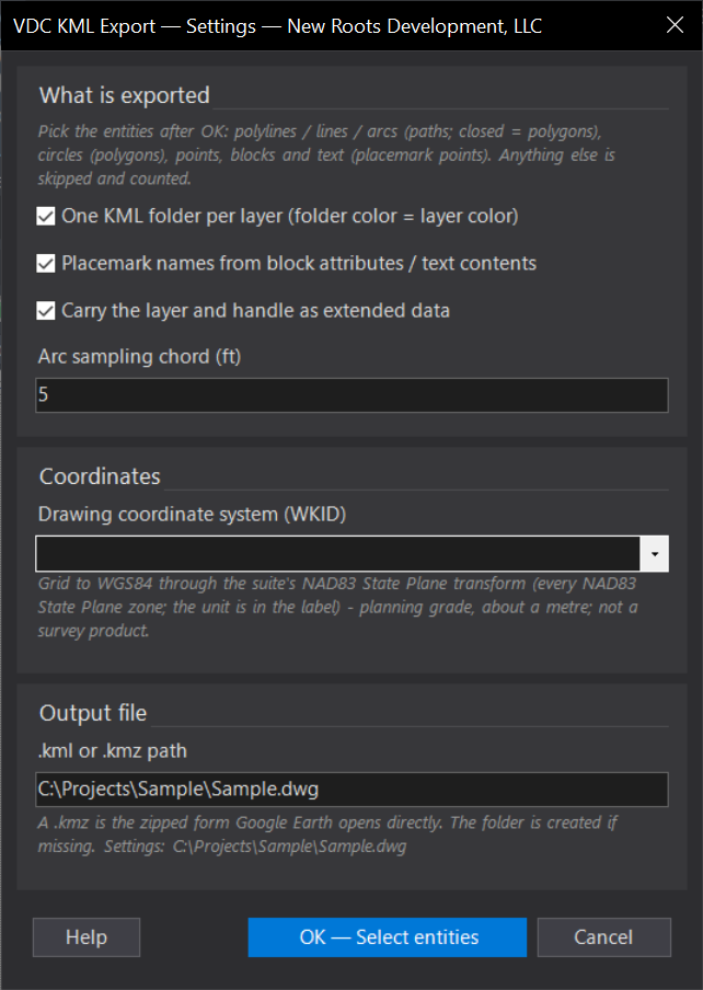
- Dialog, then pick: polylines (arcs sampled by chord), 2D / 3D polylines, lines, arcs → paths; closed polylines and circles → polygons; points, blocks, MText / text → placemarks named from the first non-empty attribute or the text; every attribute rides as ExtendedData with the layer + handle.
- One KML Style per folder from the layer color (ByLayer resolved); polygons 40 % filled; everything clamped to ground.
- Output
.kmlor.kmz(default<VDC Reports>\<drawing>.kmz); unsupported entities skipped and counted.
Import & both
- Any KML namespace and KMZ; placemarks → points (+ name label), paths → polylines, polygons → closed polylines; innermost Folder = layer
KML-<folder>with the style color; altitudes ignored. - XData
VDC_KML(folder, name, source file): re-import of the same file replaces its entities; Clear erases every import. - Coordinates: the drawing's assigned system (
VDCGEOREF) presets and locks the WKID; else the zone in the dialog; anything else is refused. - Plain AutoCAD, both bundles. Settings
%APPDATA%\VDC\Kml\settings.json. Provenance: DATA-SOURCES §3.
Dialog
VDCKMLEXPORT
VDCKMLIMPORTWhen to use it
- A site exhibit or coordination view in Google Earth for a client or a review agency.
- Sharing a lot layout, a utility route or survey points with someone who has no CAD.
How to run it
- Run VDCKMLEXPORT - set folder-per-layer, names, extended data, the arc chord, the WKID and the output path; OK.
- Select the entities and press Enter. The summary counts paths, polygons, points and skipped entities and names the file.
- Open the .kmz in Google Earth (double-click).
Options
- Folders: one per layer (default) or a single folder; folder color = layer color (ByLayer resolved).
- Names: block attributes (first non-empty attribute) and text contents become placemark names; every attribute rides as extended data.
- Arc chord: arcs and circles are sampled every N ft (default 5).
Watch out for
- Every NAD83 State Plane zone is supported (262 zones, parameters from Civil 3D's own coordinate-system dictionary); a WKID that is not a State Plane zone is refused.
- Elevations are not exported - everything is clamped to ground.
- Hatches, dimensions, leaders, xrefs and Civil objects are skipped and counted; explode or pick the underlying linework.
Related: KML Import · GeoRef · Site Data