VDCGISINFO is part of GIS Import (Shapefile / GeoJSON / KML); the full section follows.
GIS files in and out without a GIS seat: import a Shapefile, GeoJSON or KML through a layer-rule grid in the drawing's coordinate system, and write the GIS as-built deliverable from an editable jurisdiction profile as Shapefile or GeoJSON. Own readers and writers; plain AutoCAD.
GIS files
Drawing / transform
Civil objects
Verify
VDCSHPIMPORT
- Readers: Shapefile (.shp geometry incl. Z / M variants, .dbf C / N / D / L fields, .cpg encoding, .prj), GeoJSON (all geometry types, legacy crs), KML / KMZ (the suite's reader).
- Coordinates: lon/lat or the other State Plane zone → the drawing's system (VDCGEOREF assignment first); unrecognised = unchanged with a ⚠ note.
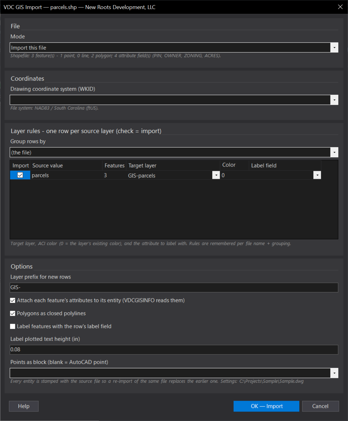
- Layer-rule grid: one row per file / KML folder / attribute value: import, target layer, ACI color, label field; remembered per file + grouping.
- Polylines / 3D polylines / closed rings / points or a block; every field of every feature on its entity (VDC record + a Civil 3D property set in the Properties palette; Object Data opt-in); re-import replaces, Clear removes.
- VDCGISINFO: pick an object → its attribute tables in a FIELD / VALUE grid (the VDC record; Map Object Data too when opted in), Copy to clipboard. Every GIS tool writes them now: Site Data, KML Import, Soils, Wetlands, Adjoiner Parcels, Flood QC.
VDCGISEXPORT
- Profile JSON per jurisdiction: layers → source (civil-pipes / -structures / -pressure-pipes / -pressure-parts / -parcels / layer:<name>) + fields (name, source property, C / N / D / L, width). Generic sample shipped, VERIFY.
- Writers: Shapefile sets (.shp / .shx / .dbf / .prj / .cpg; outer rings clockwise) or GeoJSON; drawing system or WGS84; manifest CSV.
- Pipe inverts = centerline − inner height / 2 (draft); curved pipes and bulged polylines sampled; blocks carry ATTR:<tag>, imports carry GIS:<field>.
- Plain AutoCAD exports layer sources; civil-* need Civil 3D. Settings
%APPDATA%\VDC\GisFiles\.
Dialog
VDCSHPIMPORT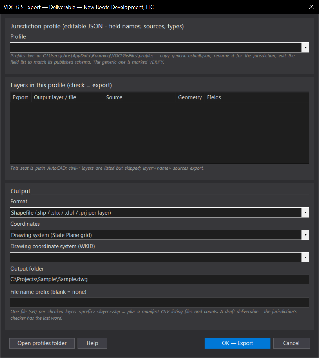
VDCGISEXPORT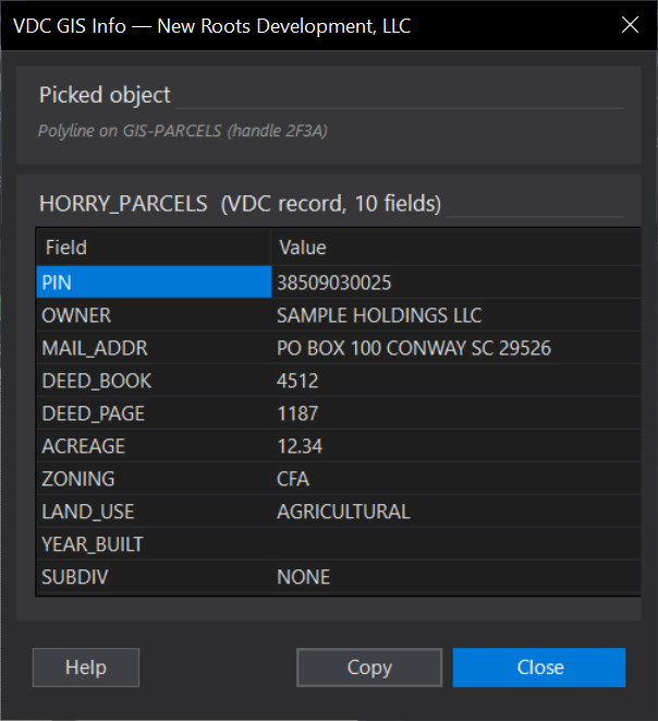
VDCGISINFOWhen to use it
- County GIS downloads (parcels, zoning, wetlands, utilities) that arrive as shapefiles.
- A consultant's GeoJSON or a client's Google Earth markup that needs to land on real layers with its attributes.
How to run it
- Run VDCSHPIMPORT and pick the file in the file dialog.
- Read the file line (features, fields, coordinate system) and the transform note; choose Group rows by (the file, or an attribute).
- In the grid check the rows to import and set target layer / color / label field; set the options; OK.
Options
- Group rows by: the whole file as one row, or one row per distinct value of an attribute (e.g. TYPE) - each value gets its own layer.
- Rules memory: layer / color / label per source value are remembered by file name + grouping for the next import.
- Attributes: every entity carries FIELD=VALUE XData (VDC_GISATTR) - the GIS Export tool reads it back.
- Points: AutoCAD points, or a block from the drawing; Z from the file when it carries it (3D polylines for Z lines).
Watch out for
- Every NAD83 State Plane zone (EPSG or ESRI code, or Esri's zone name in the .prj) and lon/lat are transformed; a projected file in some other system imports unchanged.
- A .shp without its .dbf imports geometry only; without its .prj the system is a guess (the summary says so).
- Multipatch shapes and nested KML network links are skipped and counted.
Related: KML Import · GIS Export (Deliverable) · Site Data