The companion to
VDCADJLABEL for the sliver lots too small to hold their label: swaps each cramped label for a tag, a numbered/lettered circle or plain "Lot N" text, and moves its contents into an "Adjoining Tax Parcel Information" table, one per sheet, listing only the parcels that sheet actually shows.What it does
- Auto-detect: each label's bounding box is tested against its parcel polygon at the current annotation scale; the ones that overrun are pre-checked in the confirmation grid. You have the last word on every row.
- Tag styles: Number (1, 2, 3…), Letter (A…Z, then AA, AB), or Lot number ("Lot 1", "Lot 2"…, plain text from its own
_TagLotblock, no circle, tabulated without parentheses). Your template's_TagCircle/_TagLotalways wins; a missing block is auto-created, circle + centered attribute at the plotted diameter (or attribute-only for Lot), inserted at the annotation scale. - Numbering is project-wide: resumes past the highest tag already in the drawing, so sheets never collide. A Start at value overrides.
- Tables are per-sheet: each layout's viewports are read and every tag projected into paper space (view twist included), only the tags a viewport actually frames make that sheet's table.
- Reversible: Clear restores every original MText label verbatim (stored on the tag itself), then erases the tags and tables.
Modes & settings
- Run (default): re-query every adjoiner label, fit-test, confirm, then tag + tabulate. reFresh (
F): re-pull owner/deed and rebuild every sheet's table in place, positions kept, viewport scoping re-evaluated. - Pick: select labels and force them to tags regardless of fit. Clear: restore every label.
- Table: a real AutoCAD
Table, grid lines off by default, only the header rules, matching a recorded plat. Deed mask00000/0000renders 5070 + 657 as05070/0657; a non-numeric book (J,Z) suppresses padding. - Position is yours: a new table lands in the sheet corner you choose; drag it and reFresh never moves it again.
- Owner name order / title case are read from the
VDCADJLABELsettings, so a tagged parcel reads like the labels beside it. - Settings at
%APPDATA%\VDC\AdjoinerLabels\tag-settings.json(envVDC_ADJTAG_SETTINGS); CSV beside the DWG.
Dialog
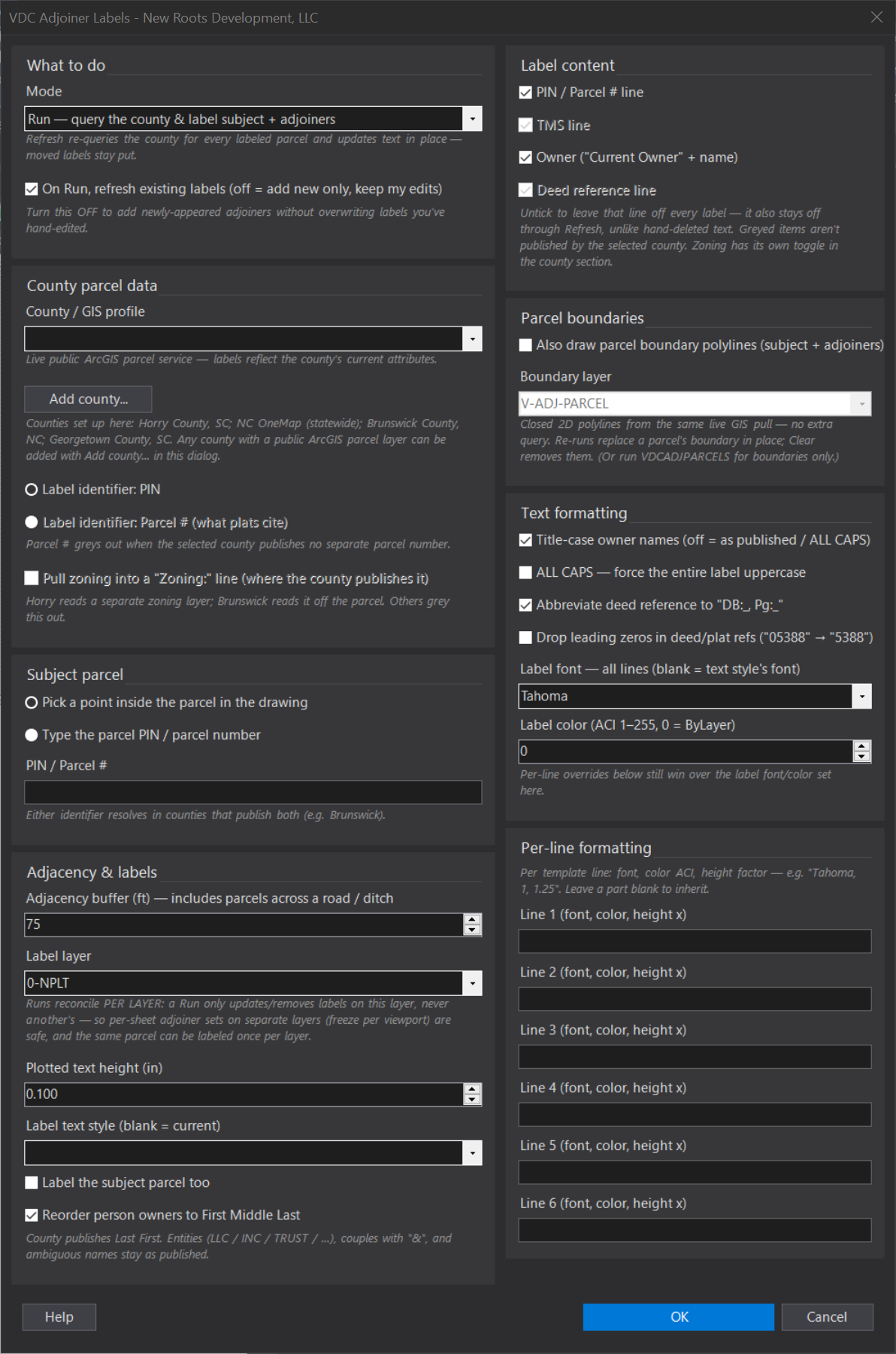
VDCADJTAG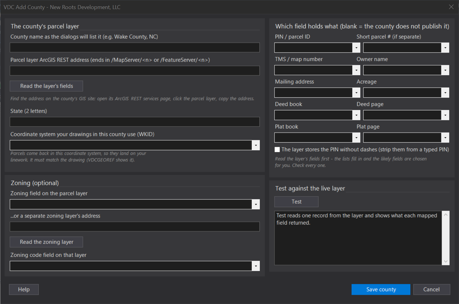
VDCADJTAGWhen to use it
- A run of narrow lots along one property line where five-line labels collide into mush.
- Building the tabulated adjoiner block a recorded plat wants instead of centroid labels.
How to run it
- Run VDCADJLABEL first so every adjoining parcel carries a label.
- Run VDCADJTAG - pick Run in the mode dialog; it re-queries each adjoiner label's parcel and fit-tests the text against the lot.
- In the grid, labels that overrun their parcel are pre-checked; tick/untick freely and type the Plat Book/Page (no county service publishes it). Click OK.
- Drag each sheet's table where the title block has room. Use Refresh mode to re-pull owner/deed and rebuild the tables in place, Pick to force a label to a tag, Clear to restore every label.
Options
- Tag block / attribute: block name (default _TagCircle) and the attribute holding the number. Your template's block always wins; a missing one is auto-created as a circle + centered attribute at the plotted diameter.
- Tag style: Number (1, 2, 3), Letter (A, B, C ... Z, AA, AB), or Lot number (Lot 1, Lot 2, ...). Lot style draws plain 'Lot N' text - its own block _TagLot, no circle - and the table lists it without parentheses; the sequence and continue-from-existing work the same in all three.
- Assign in this order: clockwise around the subject starting due north (the tidy run down a property line), or pick/query order.
- Start at / continue: numbering is project-wide - by default it resumes past the highest tag already in the drawing so sheets never collide. 'Start at' overrides and always wins.
- Tag layer / diameter / text height: plotted inches - the circle is inserted at the annotation scale, so it plots the size you asked for.
- Auto-detect: on by default. Off means nothing is pre-checked and you choose every row yourself.
- Table title / columns: title text, the Parcel-ID column header, and whether the Plat Book/Page column appears at all.
- Deed book/page mask: default 00000/0000 renders book 5070 + page 657 as 05070/0657. A non-numeric book (plat books 'J', 'Z') suppresses padding for the whole reference.
- Grid lines: off by default - only the header rules, matching a recorded plat. On draws a full grid.
- New-table corner: which sheet corner a table lands in the first time. After that its position is yours; reFresh never moves it.
Watch out for
- Run VDCADJLABEL first - VDCADJTAG only converts labels that tool placed (they carry the PIN it re-queries by).
- Network required, same as Adjoiner Labels - the table's owner/deed columns come from the county's live service.
- Plat Book/Page has no GIS source anywhere; it stays blank until you type it, then survives reFresh in the tag's own data.
- A sheet gets no table until one of its viewports actually frames a tag - and a twisted or non-plan viewport is skipped rather than mis-scoped.
- Owner-name order and title-casing are read from the Adjoiner Labels settings, not set here, so a tagged parcel reads like the labels beside it.
- No window step - like Adjoiner Labels, this works on the labels and tags the tool itself placed, so it is bounded by those, not by drawing size.
Related: Adjoiner Labels · Deed Table · Lot Table