Walks a picked parcel boundary and builds the metes-and-bounds LINE and CURVE tables: each straight side becomes an
L# row (quadrant DMS bearing + distance), each arc a C# row (radius, delta, arc, chord bearing, chord), tagging every segment midpoint and writing a CSV.
Parcel boundary
Line segment
L#
Curve segment C#
Table / CSV values
What it does
- Pick: parcels host or xref'd via the shared parcel-pick workflow; each boundary piece becomes one row in the parcel's own walk order.
- Lines: quadrant bearing in DMS (seconds rounded with carry) plus distance,
L1,L2… - Curves: radius, delta, arc, chord bearing, chord, delta from the true arc (
Δ = arc ÷ radius) so major arcs report their real central angle. - Counters: L# and C# run independently (plat convention) and continue across parcels tabulated together.
- Bearings are computed from geometry as drawn in grid coordinates, a drafting aid, not the surveyor's recorded determination.
Outputs & settings
- Segment tags (default on):
L1/C1MText at each midpoint on the tag layer, XData-stamped; Clear erases exactly these. - Tables (default on): AutoCAD LINE TABLE + CURVE TABLE at a picked point (curve stacks below), current table style + space.
- CSV (always):
{drawing} - Deed Table.csv, bearings use ASCIIdfor degrees so Excel renders cleanly. - Tag layer default
C-ANNO-DEED(auto-created); tag text height and labels are set in the dialog. - Distance decimals: 0–4 (default 2), applied to distances, radii, arcs, chords. Persisted at
%APPDATA%\VDC\DeedTable\settings.json. - Closure and label-completeness audits belong to
VDCPLATQC, this tool produces tables.
Dialog
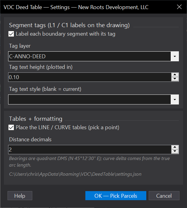
VDCDEEDTABLEWhen to use it
- Building a deed exhibit or plat line/curve table without hand-typing list output.
- Any boundary description task where transposed digits would be a recorded mistake.
How to run it
- Run VDCDEEDTABLE - pick Run in the mode dialog; set tag layer / text height, tables on/off, and distance decimals; click OK.
- Pick the parcels (window, crossing, or one by one - host or xref'd both work).
- Tags drop at each segment midpoint; pick a point for the LINE table (the CURVE table stacks below it). The CSV lands next to the drawing.
- Clear mode removes the L#/C# tags when the exhibit is done.
Options
- Segment tags: L1/C1 MText at each piece's midpoint on the tag layer (default C-ANNO-DEED, auto-created); Clear removes exactly these.
- Tables: LINE TABLE (tag, bearing, distance) + CURVE TABLE (tag, radius, delta, arc, chord bearing, chord) in the current table style.
- Distance decimals: 0-4 (default 2); applies to distances, radii, arcs, and chords.
Watch out for
- Bearings come from the geometry AS DRAWN in grid coordinates - a drafting aid for exhibits; recorded-plat bearings remain the surveyor's determination.
- Delta uses arc / radius, not the chord formula - that's deliberate: chord math caps at 180 degrees and silently mis-reports major arcs.
- Closure and bearing-label completeness are VDCPLATQC's job - this tool produces tables, that one audits plats.
Related: Lot Table · Lot QC · Adjoiner Labels