The survey control table and grid-tie note, from the points themselves.
What it does
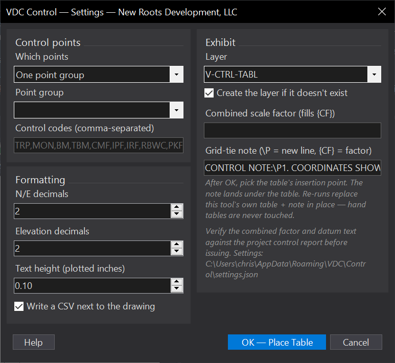
- Pick a point group, or filter every COGO point by your control codes (TRP, MON, BM, TBM, CMF, IPF, IRF, RBWC, PKF, RRF: editable).
- Draws a real AutoCAD table, POINT / NORTHING / EASTING / ELEV / DESCRIPTION at your decimals.
- The grid-tie note lands underneath: your template,
\Pline breaks,{CF}filled with the combined scale factor.
Worth knowing
- A blank combined scale factor prints a loud fill-in placeholder, never silently wrong.
- The table is static, re-run after control edits.
- Settings:
%APPDATA%\VDC\Control\(envVDC_CONTROL_SETTINGS).
Dialog
VDCCONTROLWhen to use it
- Plat and exhibit production - the control table without retyping coordinates.
- Re-running after control updates - the table regenerates from current points.
How to run it
- Run VDCCONTROL; pick the point group or accept the control-code filter.
- Set decimals, the combined scale factor, and the note template.
- Pick the insertion point - table + note land together.
Options
- Control codes: editable list; default TRP, MON, BM, TBM, CMF, IPF, IRF, RBWC, PKF, RRF.
- Grid-tie note: your template with \P line breaks; {CF} = the combined scale factor (blank prints a fill-in flag).
Watch out for
- A blank combined scale factor prints a loud fill-in placeholder - the note is not silently wrong.
- The table is static - re-run after control edits.
Related: Deed Table · Plat QC · Stake Out