Connect-the-shots, straight from the COGO points.
What it does
- Every coded shot files under its figure key (
EP1andEP2are separate lines under codeEP); same-figure shots connect in point-number order. - Description flags steer it:
BEGstarts a new line mid-figure,ENDstops one,CLO/CLOSEstops and closes it. - Line-code check-list with counts; 2D polylines at Z=0 or 3D polylines carrying shot elevations.
Good to know
- No Survey Database import needed. Layers from a per-firm code→layer CSV; unknown codes draw on
V-<CODE>. - Output is XData-stamped, so re-runs replace only this tool's linework. Straight segments in this version.
- Verify against the field sketch, connectivity comes from point numbering. Ribbon: VDC Survey → Points → Figures.
Dialog
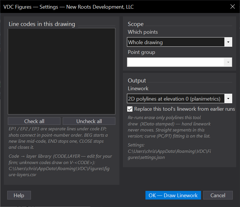
VDCFIGURESSettings file:
%APPDATA%\VDC\Figures\settings.jsonWhen to use it
- Turning a coded topo into linework without setting up a Survey Database.
- Re-drawing linework after the crew re-shoots part of the site.
How to run it
- Run VDCFIGURES; review the line-code check-list (EP - 3 line(s), 214 shot(s)) and tick what to draw.
- Choose the scope (whole drawing / window / point group) and 2D or 3D output.
- Draw; check the skipped-single-shot count in the summary.
Options
- Code -> layer library: %APPDATA%\VDC\Figures\figure-layers.csv; unknown codes draw on V-<CODE>.
- 2D or 3D: 2D polylines flattened to Z=0 for planimetrics, or 3D polylines carrying shot elevations.
Watch out for
- Connectivity comes from POINT NUMBERING, not from proximity - verify against the field sketch before the linework is trusted.
- Straight segments only in this version; curve (PC/PT) fitting is not implemented yet.
- Output is XData-stamped so re-runs replace only this tool's linework - hand-drawn linework is never touched, and never cleaned up for you either.
Related: Code Leaders · Control Exhibit · Ground Thin