Fills the PROJECT SUMMARY cover-sheet block in place: acreages, the impervious/pervious breakdown with percentages, CL road length, and lot counts, tallied live from the drawing, by matching each label line's wording and replacing only the number tokens, so the template text never restructures.
What it does
- Label-keyed: each summary line is found by its label wording (
TOTAL PROJECT AREA =) anywhere in the drawing, the cover block's definition, paper space, or model space; both inline and two-column (label + value as separate MText) layouts. - Token replacement: only
XX.XXplaceholders / previously written numbers swap; units, words ("RESIDENTIAL LOTS"), underlines, and colors around them survive. - Sources per field: hatches + closed polylines by layer token, parcels by name/style token (lot count + lot area), alignments for CL length, practice mixes all three.
- Rollups: impervious = building + asphalt + concrete; pervious = its sources or (option) total − impervious; percentages against total project area.
- Recolor on fill: a filled two-column value takes its label's color, templates often leave fields yellow until set, so filled = back to normal.
Notes & settings
- Review before write: rows missing a label line or a matched quantity start unchecked / greyed, nothing is written blind; skipped lines are itemized on the command line.
- Manual fields stay manual: PIN, zoning, permits, benchmark, authorities are not touched (PIN/zoning from county GIS is the planned v2).
- Watch the [n obj] counts in the grid, overlapping hatches double-count; the funnel line says what was scanned.
- Field catalog (labels + tokens) is editable at
%APPDATA%\VDC\CoverFill\settings.json(env overrideVDC_COVERFILL_SETTINGS), other firms' conventions work without a code change. - Every written value is stamped (
VDC_COVERFILLext-dictionary) with the field, value, and date.
Dialog
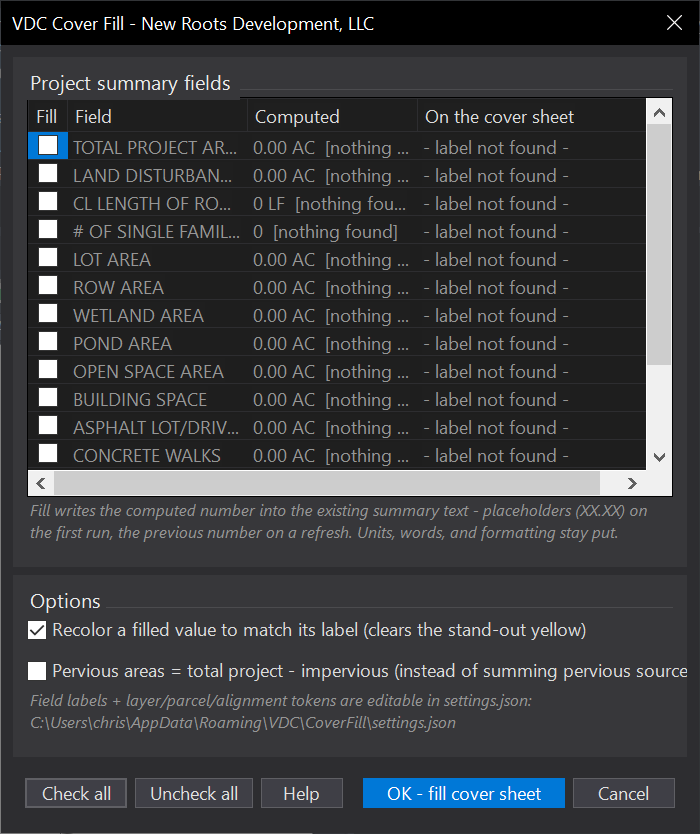
VDCCOVERFILLWhen to use it
- Setting up or updating a cover sheet whose summary still says XX.XX ACRES.
- The design changed (lots added, disturbance limits moved) and the summary must catch up.
How to run it
- Open the cover sheet drawing and run VDCCOVERFILL.
- Read the review grid: computed value vs. what the sheet currently says, per field.
- Uncheck anything you don't want written and click OK - fill cover sheet.
- Re-run any time to refresh - the numbers it wrote are themselves replaceable tokens.
Options
- Recolor filled values: a filled two-column value takes its label's color, clearing the stand-out yellow.
- Pervious = remainder: compute pervious as total project minus impervious instead of summing pervious sources.
- Field catalog: labels + layer/parcel/alignment tokens are editable in settings.json for other conventions.
Watch out for
- A field only fills when its label line exists on the sheet AND a quantity source matched - the grid greys out anything unmatched.
- Areas come from what the tokens match (mostly hatches; parcels and bare polylines too) - overlapping objects double-count, check the [n obj] counts.
- Manual fields (PIN, zoning, permits, benchmark, authorities) are left alone - this fills the computable numbers only.
- The summary must live in THIS drawing (block or space) - an xref'd summary is read-only and skipped.
Related: FIRM Note · Quantity Takeoff · Lot Table · Erosion Control