Tabulates numbered callout multileaders and/or COGO points by station and offset against a reference alignment: anchoring on the multileader arrowhead or the point, reading the key from bubble text / point description, sorting numerically (
1.1 < 1.2 < 1.10 < 2.1), and writing a CSV plus an optional AutoCAD table.
Reference alignment & table
Callout multileader (arrowhead anchor)
COGO point (next series)
Station / offset measure
What it does
- Pick + window-select: choose the reference alignment, then window-select multileaders, COGO points, or a mix.
- Anchor: a multileader's arrowhead (the point it indicates); a COGO point's location.
- Callout key: the multileader MText, the first block attribute for a block-based bubble, or the COGO point's raw description.
- Station / offset: measured against the alignment, signed offset,
+/ RT looking up-station,LTto the left. - Numeric sort: segment by segment so
1.1, 1.2 … 1.10, 2.1order as a plan reader expects, not a string sort. - Read-only source: harvested objects are untouched; only the new table is created.
Columns & outputs
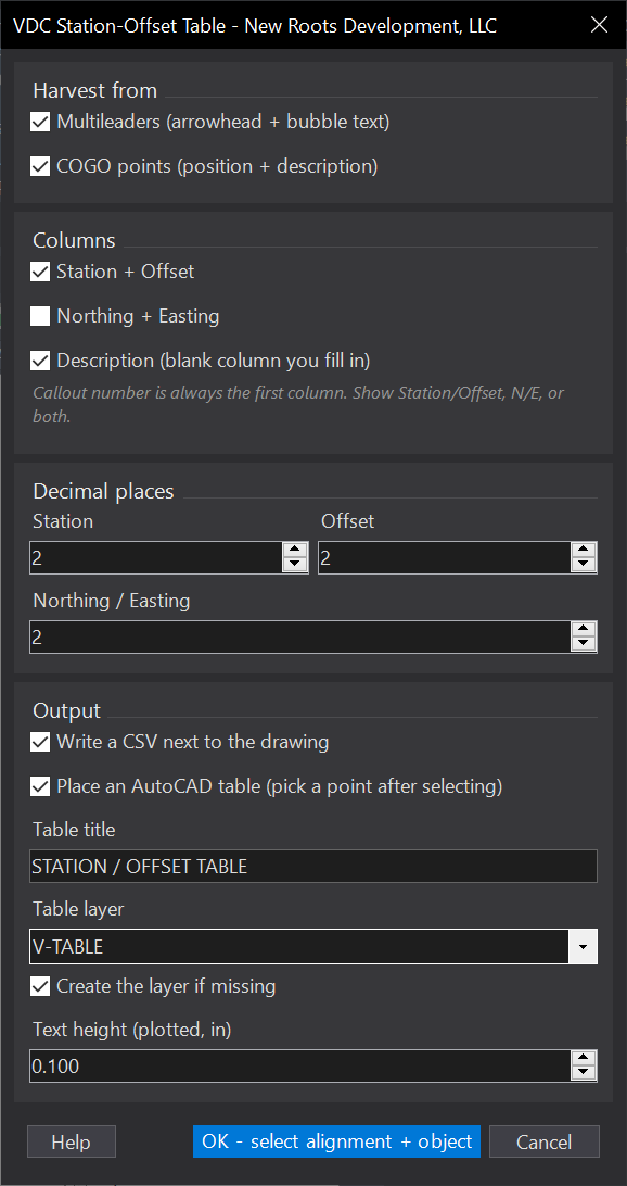
- Callout first (the harvested key), then Station / Offset; decimal places configurable.
- Northing / Easting optional, in lieu of or alongside station/offset.
- Description: optional blank column you fill in on the placed table.
- AutoCAD table at a picked point in the drawing's current table style; sized from plotted text height × annotation scale.
- CSV:
<drawing folder>\<drawing>-StationOffset.csv(Documents if unsaved). - Settings:
VDC_SOTABLE_SETTINGS, default%APPDATA%\VDC\StationOffsetTable\settings.json; schema-tolerant. Raw station only (equations not applied); bare bubbles with no arrowhead are skipped.
Dialog
VDCSOTABLEWhen to use it
- Producing a station/offset schedule for callouts or staking points.
How to run it
- Run VDCSOTABLE and pick the reference alignment.
- Select the callout multileaders or COGO points.
- Choose columns (N/E, blank description) and place the table / export the CSV.
Watch out for
- Pick the correct anchor (arrowhead vs point) so station/offset are measured from the right spot.
Related: Stake Lots · Multi-Offset