VDCNWL is part of Profile Elevation Line (NWL / BFE / weir); the full section follows.
Draws a horizontal elevation line across picked profile views: the pond NWL, a BFE, a weir crest, at a typed elevation, extended a chosen distance past each side of the view. NWLs stay visible in profiles without sampling water surfaces into the surface list.
What it does
- Dialog first: elevation, per-side extensions (default 25 ft), layer (default
C-WATR-NWL, auto-created cyan), linetype (defaultDASHED, auto-loaded from acad.lin), optional label (NWL = {ELEV}). - Then pick views: click inside each profile view; the line lands at the elevation spanning the view's full station range plus the extensions. Any vertical exaggeration is handled per view.
- Elevation keyword: the pick prompt changes the elevation between ponds via a small input dialog, no reopening settings.
Worth knowing
- An elevation outside a view's grid range is skipped and reported.
- Lines are plain 2-vertex polylines, grip-edit or erase like any linework; they do NOT follow later regrades.
- Label height is plotted inches converted by the current annotation scale (non-annotative, suite convention).
- Settings:
%APPDATA%\VDC\ProfileLine\settings.json(envVDC_PROFILELINE_SETTINGS).
Dialog
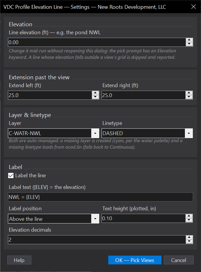
VDCPROFLINEWhen to use it
- Showing a pond's normal water level on its outfall/road profiles without a water surface.
- Any fixed elevation worth a line across a profile view - BFE, weir crest, HGL checkpoints.
How to run it
- Run VDCPROFLINE (or VDCNWL) - set the elevation, per-side extensions, layer/linetype, and label in the dialog.
- Click inside each profile view that gets the line.
- Use the pick prompt's Elevation option to change the elevation between ponds - no need to reopen the dialog.
- Press Enter/ESC to finish; the summary counts lines drawn and views skipped.
Options
- Extension: how far past the LEFT and RIGHT edges of the view's grid the line runs (set each side).
- Elevation keyword: changes the elevation mid-run and saves it as the next default.
- Label: optional text at the line's left end, ABOVE or BELOW the line (dropdown); {ELEV} becomes the elevation at your precision.
Watch out for
- An elevation outside a view's grid range is skipped and reported - stretch the view's elevation range first if the line must show.
- Lines are plain polylines - they do NOT move if the profile view or the pond design changes; re-draw after a change.
- The label height is plotted inches converted by the CURRENT annotation scale - set the working scale before running.
Related: Surface Profiles (Batch Sample) · Pipe Views · Profile Pipes