Slabs to linework: slice a LAS file at elevations, at heights above a TIN, or along a polyline / alignment; the points in each slab become polylines on a layer per slice. Every extraction number is in the dialog.
Elevation slab
Height-above-TIN slab
Extracted linework
What it does
- Slices: elevations (list or
100-110 step 2), heights above a TIN, along a picked polyline or an alignment (vertical sections). - Extraction: grid bin → components → RANSAC straight segments → Douglas-Peucker curves → endpoint join; every number editable, every step unit-tested.
- Output: 2D or 3D polylines, a layer per slice, Replace / Clear per source file.
Watch for
- It traces what the points show, cars, people and vegetation in the slab included. Review the draft.
- No points in the window = the cloud is not in the drawing's coordinates.
- TIN and alignment modes need Civil 3D; plain AutoCAD gets elevation and polyline slices.
Dialog
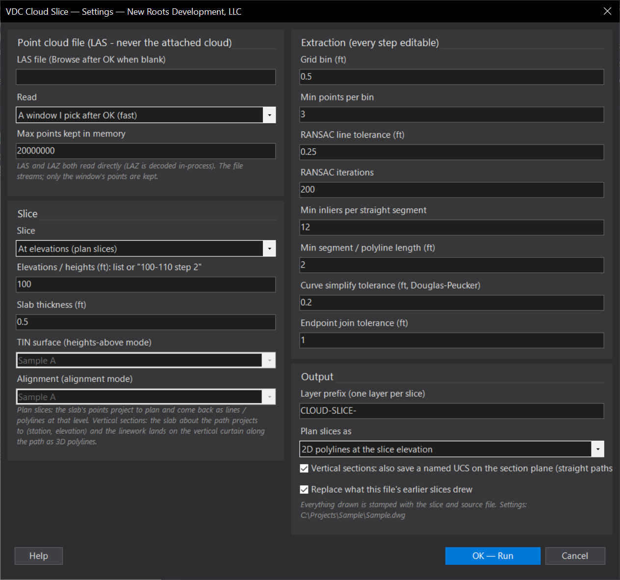
VDCCLOUDSLICESettings file:
%APPDATA%\VDC\CloudSlice\settings.jsonWhen to use it
- Curb lines, walls and building faces from a drone or scanner cloud without tracing by hand.
- Existing contours at a set interval straight from the cloud (elevation slices).
- A cross section of a ditch, wall or road along a picked line (vertical section + UCS).
How to run it
- Run VDCCLOUDSLICE; leave the LAS path blank to browse after OK; read a window (fast) or the whole file.
- Choose the slice: elevations, heights above a TIN, along a polyline you pick, or along an alignment; set the levels and slab thickness.
- Adjust the extraction numbers if the first pass is too busy or too sparse (grid bin, RANSAC tolerance, min inliers, simplify, join).
- OK - pick the window (and the polyline) on screen; read the summary; the polylines land on the slice layers.
- Re-run with Replace on to redo the same file's slices; Clear erases everything the tool drew.
Options
- Slice: elevations (plain AutoCAD), heights above a TIN (Civil 3D), along a picked polyline (plain AutoCAD), along an alignment (Civil 3D).
- Slab thickness: 0.5 ft default - thicker slabs catch sparse clouds, thinner ones give crisper lines.
- Grid bin / min points per bin: 0.5 ft and 3 by default; raise the bin for sparse flights.
- RANSAC tolerance / iterations / min inliers: how straight a run must be to become one straight segment (0.25 ft, 200, 12).
- Simplify / join: Douglas-Peucker 0.2 ft on the curves; endpoints within 1 ft are joined.
- Plan slices as: 2D polylines at the slice elevation, or 3D polylines through the points' own Z.
- Max points: the in-memory cap (20 M) - read a window instead of the whole file on big clouds.
Watch out for
- The cloud must be in the drawing's coordinates - a window with no points is the first sign it is not.
- This traces what the points show, including cars, people and vegetation in the slab - review the linework, it is a draft.
- Vertical sections lay the linework in the section plane (station along, elevation up) - the named UCS is how you look at it; a curved alignment section gets no UCS.
Related: Ground Thin (Lidar to Ground Shots) · Cloud Assets (Poles, Signs, Trees, Hydrants) · FL from Points